
Marine Geology Services
Marine Geology Services
– PETROPHYSICS AND ROCK PHYSICS
– GEOPHYSICAL INTERPRETATION
– GEOLOGICAL INTERPRETATION
|
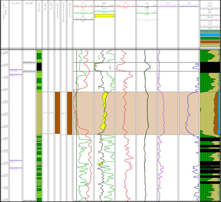
PetrophysicsFormation evaluation, calculation of porosity, fluid saturation, permeability. Our experts analyse micro imager results for the identification of thin reservoirs, quantitative assessment of fractured reservoirs, identification of unconformities, dips of layers. |
|
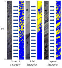
Digital petrophysicsOne of the developing technologies that analyses core photos and determine lithology, saturation type, and sedimentary structures. This techniques improves understanding of the heterogeneities, valuable in precise reserves calculation and upscaling for determination of interdependencies with elastic properties. |
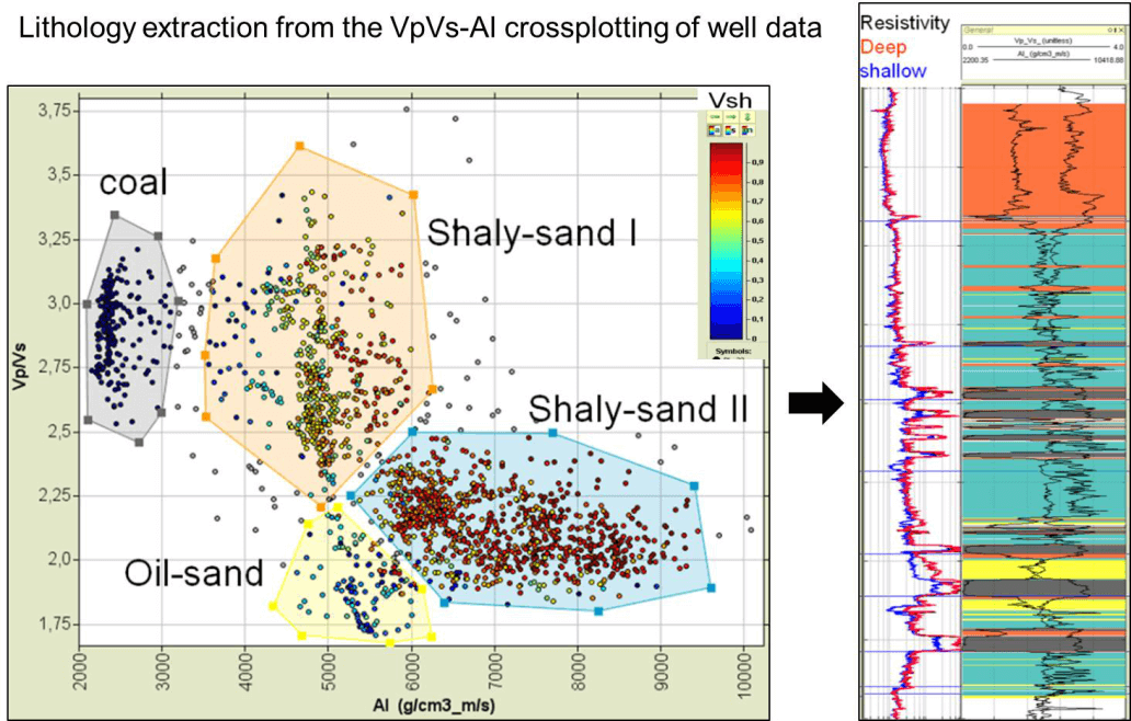
Determination the response of reservoir properties to elastic properties of the medium (acoustic impedance, shear impedance, Vp/Vs), for fluid substitution analysis – alteration of elastic properties in dependence on the character and volume of saturation
VSP-analysis: interpretation of all kind of VSP modifications including registering S waves, which are essentials for the multicomponent data.
AVO-analysis: the AVO results intercept and gradient cubes and the linear derivative Fluid Factor are used for prediction of lithology, saturation and well as other parametres via Neural Nets.
Acoustic Inversion is useful in detailed correlation of horizons aimed at resolution of thin beds and tracing of sedimentary bodies as a part of analysis of sedimentation
.Simultaneous Inversion results in Vp, Vs, Vp/Vs, and Density cubes which are meaningful in separation of the Reservoirs and non-Reservoirs in the seismic domain. For calculation of the density cube, it is absolutely vital to obtain the far angle stacks in the acquired data.
Joint Inversion results in Vp, Vs, Vp/Vs, and Density cubes on the basis of registered data of the share wave.
Results of Rock Physics are used in calculation of cubes of lithology, facies, porosity or any other geological parametres:

Sedimentological, lithological, petrophysical, and geochemical studies of core: detailed characterisation of source rock, reservoir, and seal. Identification of lithology, porosity type and distribution, heterogeneity analysis, and identification of facies.
Integration of multi scale data – core, logs, seismic, gravity, magnetics, satellite images for:
|
Tools and approaches we apply:
|
Modeling we perform:
|
